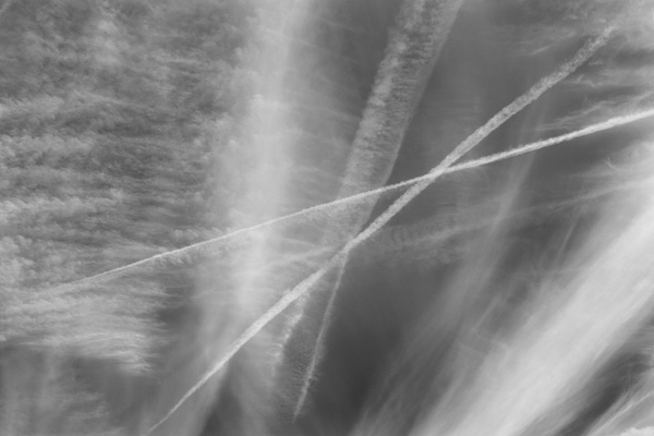
Contrail Cirrus 241, 18 May 2023
Cirrus Aviaticus
John Davies has been making B&W infrared photographs of the
north sky above Liverpool and Lancashire in north west England since
2013. The span of each cloud photograph represents a distance of at
least six miles across the sky.
These images are of the high-altitude cirrus clouds made of ice crystals.
They focus specifically on the visible contrails (condensation
trails) and contrail-induced cirrus clouds produced from jet engine
exhaust fumes. These are mostly generated by commercial flights that
typically cruise at six and a half miles above sea level.
Cirrus covers an average of 31.5% of the Earth's surface (CALIPSO
satellite data). Increased air traffic has been implicated as one
possible cause of the increasing amount of cirrus in Earth's atmosphere
- contributing to climate change through Radiative Forcing*. Most
all jet engines also emit substantial amounts of CO2 (carbon dioxide).
At the global level CO2 is the most important greenhouse gas: the
warming effect of CO2 emissions being long lasting and cumulative.
Scientific research suggests contrails and contrail cirrus clouds
are the largest net warming component of aviation emissions. This
impact needs to be considered alongside continuing CO2 mitigation
strategies.
* The Radiative Forcing effect is where the balance is disrupted
between radiation coming to the earth from the sun and heat emitted
from the surface of the earth going out into space. Source: Imperial
College London’s department of Environmental Engineering.
-
Images may not be reproduced in any form or by any
means without the permission of John Davies
Photo and material Copyright © John Davies 1976 - 2023
|